PT Explora Prima | Survey Specialist

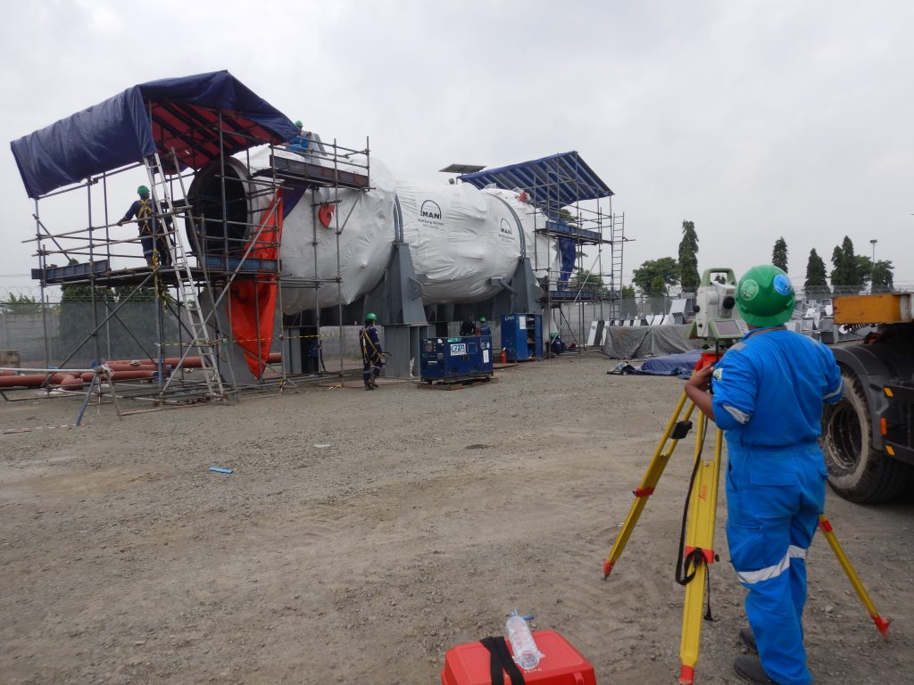
Precision surveying has become an increasingly crucial aspect of infrastructure development and maintenance. As industries continue to evolve and expand, the need for accurate and reliable data on the topography, structures, and infrastructure of a given area is essential for informed decision-making processes. The ability to collect precise data on positions, elevations, and orientations within a site allows for the creation of detailed maps and models that can significantly impact the planning, design, construction, and maintenance of various facilities and structures.
Moreover, precision surveying enables organizations to identify potential issues or challenges within their infrastructure, allowing for proactive solutions and mitigation strategies. This not only enhances the overall efficiency and sustainability of operations but also ensures the safety and well-being of personnel working within these facilities. Additionally, accurate survey data can also contribute to the optimization of resources and the reduction of environmental impacts, further demonstrating the importance of precision surveying in infrastructure development.


Explora Prima partnered with the client consortium of ETI Yuhantech PBAS, to collaborate on providing precise survey solutions in the RCC area of Pertamina RU VI. The survey activity, spanning 18 days, was conducted with the aim of delivering data necessary for monitoring, mapping, and optimal planning of the area.
At Precision Survey, we know how essential state-of-the-art technology is when it comes to delivering accurate results. That’s why Explora Prima experienced team of experts use cutting edge survey equipment and sophisticated techniques in all of their work.
Utilizing Global Positioning System (GPS) devices which provide exact positioning, and other precision measurement tools, our fantastic team can give incredibly precise data about the Residue Catalytic Cracking (RCC) area at Pertamina RU VI which includes factors such as elevation, as well as location.


The team was success to gather accurate data over an 18-day period, which will serve as a strong foundation for future initiatives within the area. With this information at hand, decision-makers can make informed choices regarding the planning, maintenance, and sustainable development of the RCC area, ultimately leading to improved operations and long-term success.
We are immensely grateful to the client consortium of ETI Yuhantech PBAS for placing their trust in PT Explora Prima to carry out Precision Survey work at the RCC site. As a dedicated team, we are committed to delivering the highest quality solutions and services to support Pertamina RU VI’s ongoing efforts towards sustainable development and operational excellence.
If you would like to learn more about our Precision Survey services, we are always available to answer your questions. Simply get in touch with us using the contact details found on our website. Thank you for visiting us and we hope to work with you on many successful projects in the future, as your reliable partner.