Ground Penetrating Radar (GPR) BP Batam
Project detail
Every construction site needs to be surveyed before every use, so the Ground Penetrating Radar method is a good way to do that.
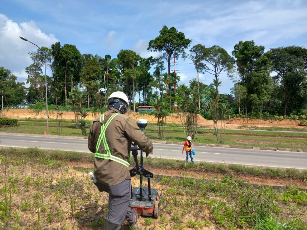
Before building anything somewhere, the site must be assured of not having any flaws in the planned building. For that reason, some surveying activities have to be done, and Ground Penetrating Radar, or GPR is a perfect method to do the job.
What is Ground Penetrating Radar
Similar to seismic reflection, GPR is a method used to detect structures below the surface. However, instead of using acoustic energy like seismic reflection, electromagnetic energy is used in GPR.
GPR successfully detects changes in electrical characteristics below the surface with high-frequency radio waves as electromagnetic energy. On the other hand, seismic energy notices changes in the mechanical characteristics of the subsurface.
How GPR Works
To capture some images below, an antenna and a transmitter are necessary for GPR. The transmitter has a role to transfer the energy beneath the surface. Then, if there is an object there, the energy will be obtained by the receiving antenna. Ground Penetrating Radar uses microwave radiation waves with a frequency range of 1 to 1000 MHz.
Any signal hitting something beneath the surface will be reflected and scattered. The impacted signal then being translated by software capable of changing it into images of the objects. If it is clear what is there under the ground, the survey is successful.
Detectable Materials
It is useless for surveying if it can only detect very few sources of materials. That is why Ground Penetrating Radar is able to differentiate some underground items from various materials, namely metal, concrete, PVC, plastic, and other natural materials.
The ability to detect those various materials makes GPR great for many applications, such as detecting rock formations, ground transformations, underground voids, dug-up areas, lines and pipes, and others.
Where to Use
GPR can be used to penetrate signals through many kinds of ground surfaces. The range of the transferred signal can be different depending on the surface, although some signals will be reflected back to the antenna if it hit an object. The suitable surfaces are soil, ice, rock, fresh water, concrete structures, and pavement.
Based on the surface, the performance of the Ground Penetrating Radar can be affected thanks to the different levels of dielectric permittivity. The dielectric permittivity is the one giving reflection for the signal. With that being different, the strength of the signal will vary.
For instance, a pulse going from dry sand to wet sand will result in a far stronger reflection than the comparatively mild reflection resulting from dry sand’s movement to limestone.
For the depth, GPR can transfer signals as deep as 30 meters beneath the ground. However, if the surface and the frequency are less suitable, the signal can only reach one meter or even less.
The Advantages of Using GPR
When used in conjunction with conventional locating techniques, GPR technology is utilized in subsurface utility mapping to improve the accuracy of their job. GPR helps in subsurface mapping, excavation projects, and finding unmarked utilities and structures.
In the world of surveying, Ground Penetrating Radar will give many advantages when used properly. It is clearly one of, if not the best, ground surveying methods available. The benefits of applying GPR are as follows:
- GPR can be used anywhere for any project site without causing any danger.
- GPR is able to detect any materials, whether they are metal or not, including the unpredictability of something beneath the surface.
- The possibility of measuring the depth, thickness, and dimensions of the surveyed ground is there with GPR.
- The covering area of GPR is wide without needing extra time for the data.
- A one-sided scanning is enough to get the required data.
- In order to produce a variety of resolutions and penetration depths, frequencies can be controlled.
- Data from Ground Penetrating Radar are available straight away and can be seen or saved for later.
- By using GPR, surveying jobs do not require any ground destruction, such as excavating or digging.
- The landscape on any surveying sites will not be changed.
- Using GPR is one of the cheapest surveying methods out there.
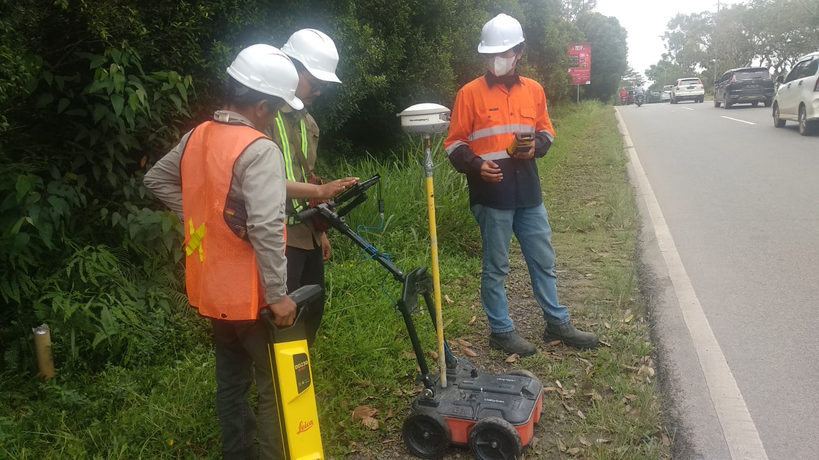
Any ground surveying service offered by Explora Prima uses Ground Penetrating Radar, same as the work we have done with BP Batam. Using GPR we conducted a survey to find underground utilities such as power cables, optical fiber, water pipes, sewage, aviation fuel pipes, etc. along approximately 13 KM where the location will be built as a road.
With a processing deadline of approximately 13 working days, data can be collected and processed for purposes as needed.
With accurate results, of course, it will greatly assist in the planning and development of road management. So every client will get the best result. With this, any ground will not be destroyed every time a new infrastructure or building is about to be built.
Details:
Location:
Jl. Sudirman (Taman Dang Anom) - Simpang Bandara (Hang Nadim)
Category:
Georadar Subsurface Utility Scan
Client:
BP Batam
Date:
11/10/2022
faqs
Frequently Asked Questions
We regularly partner with clients across multiple demanding sectors, providing specialized survey support for Oil & Gas, Maritime and Hydrographic operations, Shipyards, Mining sites, Civil Infrastructure, and Plantations.
To ensure high precision and reliable deliverables, we utilize industry-standard instruments such as High-Definition 3D Laser Scanners, Hydrographic Echosounders, and UAV LiDAR systems, combined with advanced data processing software like Leica Infinity.
Timelines vary depending on the site location, area scale, and specific scope of work. While routine land or hydrographic surveys can be completed in a matter of days, more complex or large-scale projects require a structured timeline that we outline prior to mobilization.
We provide comprehensive, client-ready digital deliverables customized to your engineering and operational needs—ranging from 2D CAD layouts and 3D point cloud models to bathymetric charts and detailed technical reports.
Yes, we are. Backed by certified survey personnel, robust field equipment, and our certified ISO 9001:2015 quality management systems, we are fully prepared to execute both large-scale onshore and offshore assignments.
Getting started is easy. You can fill out our website inquiry form, email us directly, or reach our office team by phone so we can discuss your project requirements and provide a proper consultation.